Network of the Americas
Network of the Americas
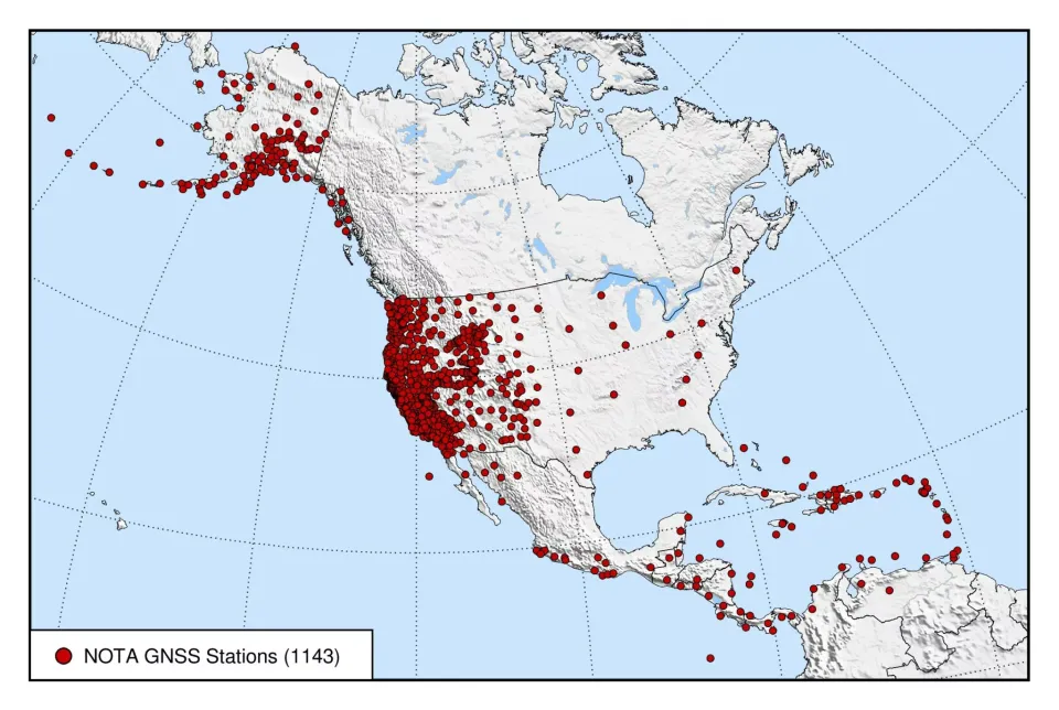
The Network of the Americas (NOTA) is an international geophysics sensor network spanning more than 20 countries and composed of more than 1,200 continuously operating instruments, including high-precision GPS (and multi-constellation GNSS) stations and borehole strain, seismic, and tilt instruments. The footprint of the network stretches from the Aleutian Islands to the Caribbean. It precisely measures the slow movement of tectonic plates and the sudden movement of earthquakes, among other solid Earth, hydrological, and atmospheric phenomena.
Under the NSF National Geophysical Facility, EarthScope Consortium has integrated and federated pre-existing, NSF-funded GPS networks into a single pan-American network that included the Plate Boundary Observatory (PBO – spanning Alaska, the continental US, and Puerto Rico), TLALOCNet (40 stations in Mexico—MRI funded), and COCONet (85 stations spanning the Caribbean). The result is the Network of the Americas.
What equipment is present at a NOTA station?
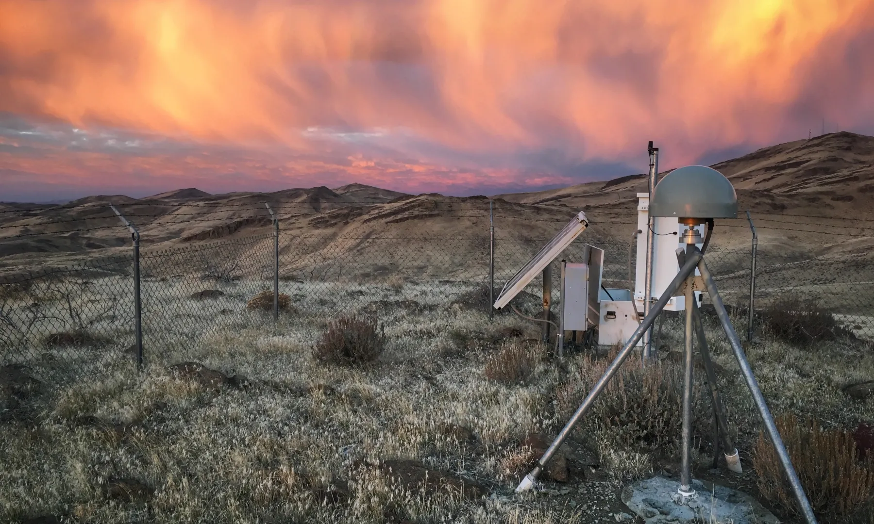
The enclosure box with the solar panels includes batteries, charging controls, and two key devices. One is the GNSS receiver, which records the satellite signals, calculates the station’s position, and stores this data. The other is responsible for transmitting the data back to our archive ― sometimes this is a cell modem, sometimes it is a satellite connection (such as Starlink), and sometimes it is a radio.
The part of the station that looks like a gray ball on a tripod is the GNSS antenna. Inside the plastic dome is a special circular antenna designed to maximize the signal from navigation satellites. It is mounted on steel legs that are anchored securely into the ground. This is the where the station’s position ― and the movement of the ground ― is measured. A cable connects this antenna to the GNSS receiver inside the enclosure box.
Any vegetation or objects around the antenna can interfere with the incoming satellite signal, reducing data quality. Locations are chosen to maximize their unobstructed sky view, but maintenance visits sometimes involve trimming opportunistic bushes that have grown up around the antenna.
Some stations include other instruments, like meteorological packs. A smaller number of NOTA stations feature strainmeter instruments in a borehole.